Pajaro Flood Archive
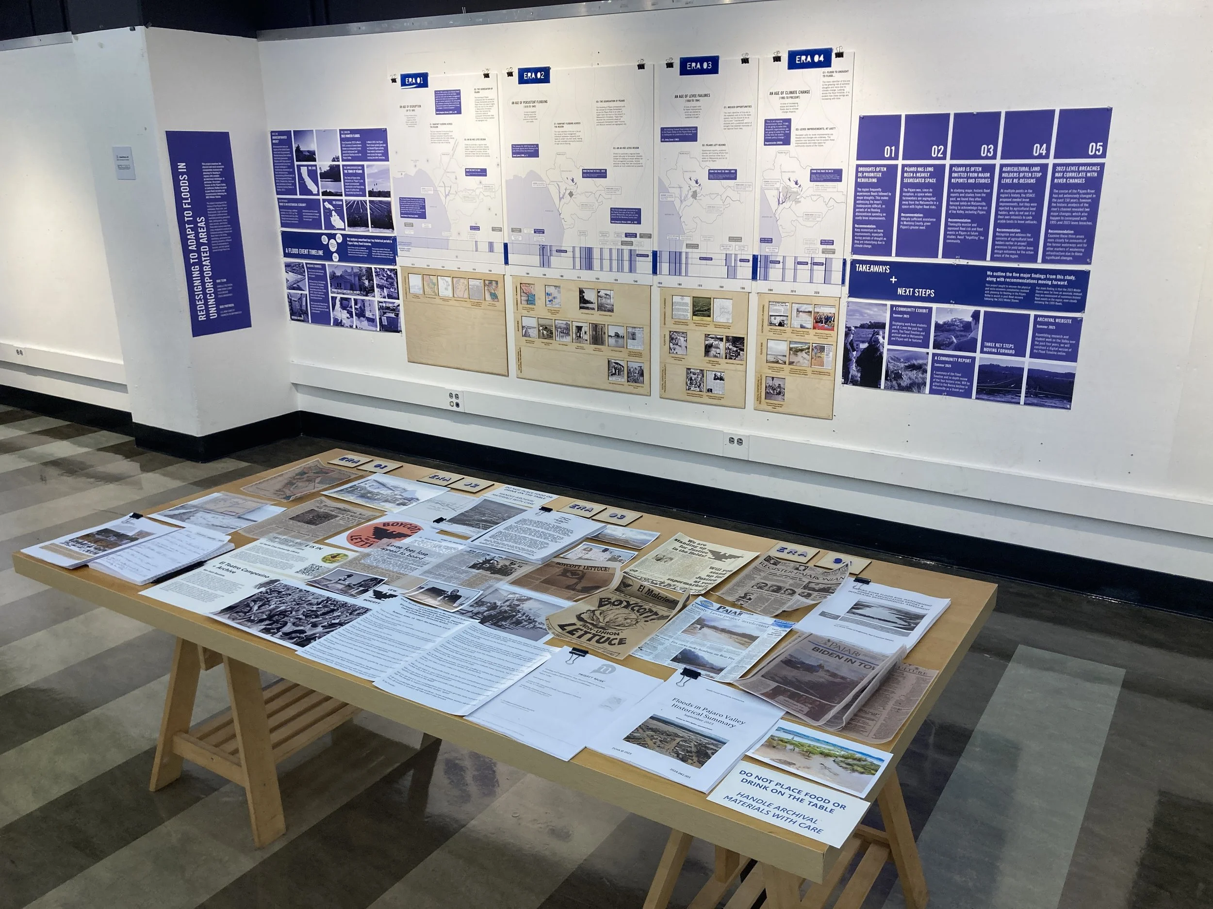
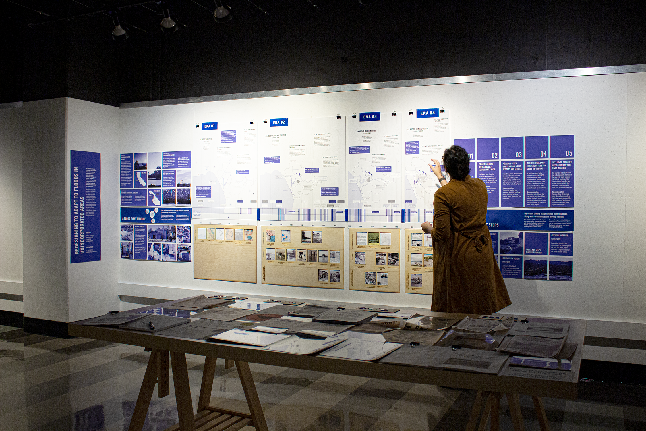
Exhibit View: Redesigning to Adapt to Floods in Unincorporated Areas
April 7-29, 2025 - University of California Berkeley - College of Environmental Design
Authors: Danielle Zoe Rivera and Eliza Breder
Government Partner: U.S. Army Corps of Engineers at San Francisco
Funding: Lau Climate Futures Grant from UC-Berkeley’s Institute of Urban and Regional Development
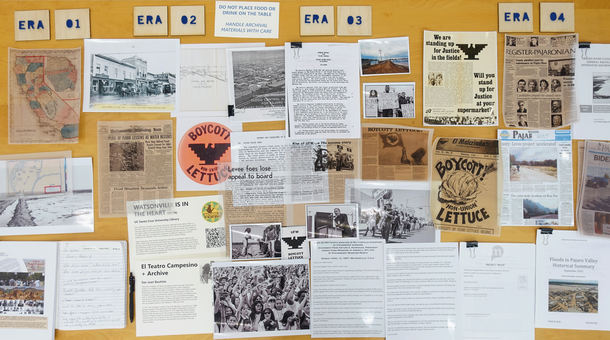
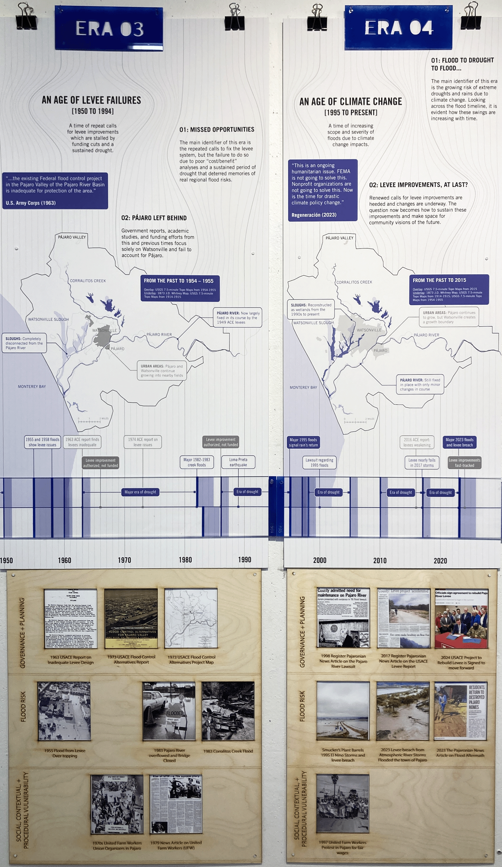
This project examines the difficulties in planning for flooding in regions with complex jurisdictional challenges. In particular, the project focuses on the Pájaro Valley in California (Valley) to assist in post-flood recovery and reconstruction following the 2023 Winter Storms. To do so, the project investigated the history of the Pájaro Valley’s waterways, flood risks, and flood events. To find this information, eight archives throughout the Bay Area and California were searched providing geospatial data, photographs, maps, news articles, and stories. These data sources were then cross-analyzed to construct a Flood Risk Timeline identifying four key periods in the region’s history of flooding.
Given the auspicious timing of this study, its goal is to better inform recovery and reconstruction efforts following the 2023 Winter Storms, assisting government partners in the U.S. Army Corps of Engineers in San Francisco. The findings of the historical ecology study are further analyzed to increase public awareness of the natural, social, and political processes which may contribute to the widespread flooding experienced in the Valley in 2023. From this, we identified five core findings and made policy recommendations for regional leaders and our government partners. These final policy and design recommendations pay particular attention to the jurisdictional challenges and complexities experienced in this region, especially as they impact its unincorporated areas (areas lacking citydom). Our hope is that these histories will help mitigate regional flood risk.


The exhibit at UC-Berkeley highlighted our research process, our data analysis from the archives, and our findings and recommendations.

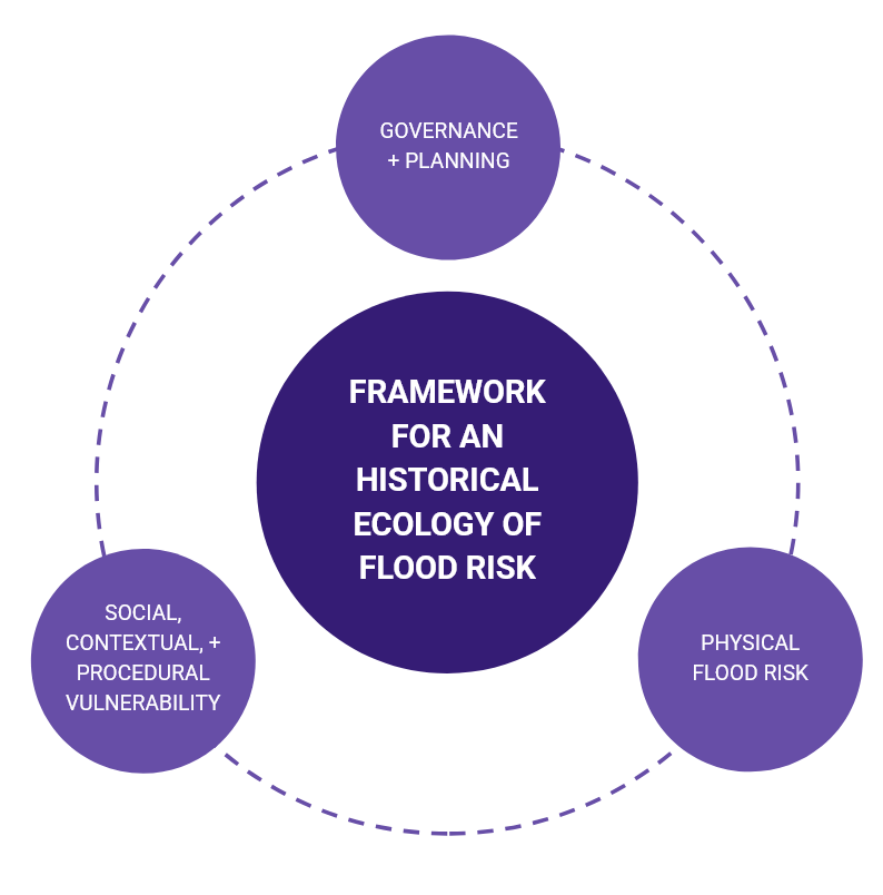
An historical ecology is defined by Beller, et al. (2017) as “the study of nature over time, often (though not necessarily) with a focus on human–environment interactions and the causes and consequences of changes caused by human actions in the recent past.”
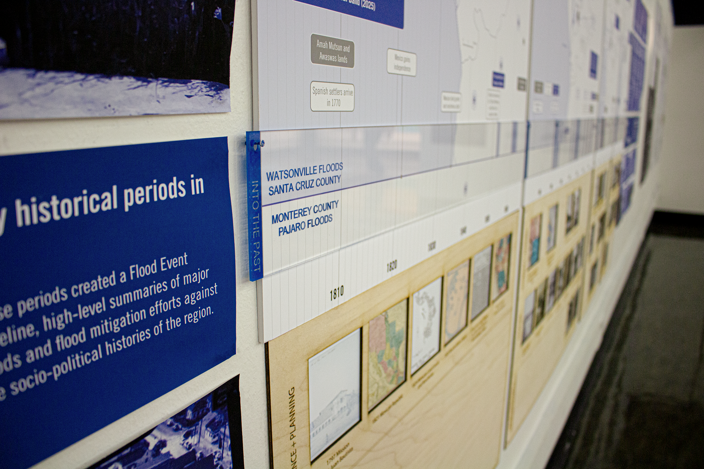
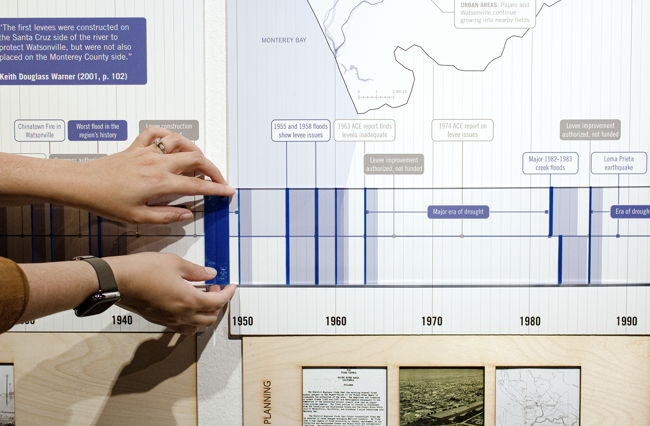
The historical ecology of flooding and flood risks in the Pájaro Valley describes the persistent and compounding flooding which has occurred throughout the Valley’s history. It also describes key historic developments in the generation of flood risks throughout the region’s history. This historical ecology of Pájaro Valley flooding and flood risk was created with data from eight state and regional archival sources. The data from these sources were then cross analyzed using as a framework. This framework for an historical ecology of flood risks acknowledges the roles played not just by the physical environment, but also governance and social dynamics in the creation of flood risks through three lenses which, taken together, generate flood risks over time:
Physical Flood Risk: This encompasses the physical environment of the region, across time, and how it structures flood risk. Here, the physical environment refers to many aspects driving the form of the environment including: topography and topographical changes, changes in regional waterways, and histories of development and changes in development.
Governance and Planning: This recognizes the key role that local jurisdictions, regional organizations, or federal agencies play in either addressing or under examining flood risks.
Vulnerabilities: This refers to how undue burdens of flood risks are associated with socio-economic and demographic trends across the region and through its history. Here, we examine three forms of vulnerability. First is social vulnerability which identifies undue burdens of risks based upon one’s identity. Second is procedural vulnerability which identifies how undue burdens of risk are generated in the processes of governing and implementing projects and programs. Lastly is contextual vulnerability which refers to how historical processes over time exacerbate undue burdens of risk. Taken together, these three lenses provide a deeper analysis of which areas of the Pájaro Valley are unduly burdened by flood risk currently and historically.
From this framework, we were then able to identify four key time periods in the Pajaro Valley’s history of flooding and flood risk creation (which are specific to the Pájaro Valley itself):
Era 01 Pre-1869: Age of Disruption
Era 02 1870-1949: Age of Persistent Flooding
Era 03 1950-1994: Age of Levee Failures
Era 04 1995-Present: An Age of Climate Change
2025
photography, reports, interviews, blue prints, planning documents, archives
Thirty four 2”x 4” historic photographic prints framed by birch wood, engraved. Four spatial timeline panels mounted on backer board.
“Lau Climate Futures Exhibit 2025” UC-Berkeley’s Institute of Urban and Regional Development, 2025


Many thanks to the following archives for making this work possible:
Borina Archive, Pajaro Valley Historical Association
McCone Archive, UC-Berkeley
The Bancroft, UC-Berkeley
California Archive, Online
Amah Mutsun History, Online
UC Santa Cruz, Digital Collection
The David Bacon Photography Archive, Stanford
News Archive, Watsonville Public Library